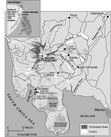
Country: Philippines
[ Hazard ]
Event Date
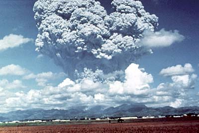
June 15, 1991
Volcanic Explosivity Index (VEI)
6
Notable Features
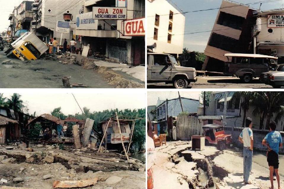
• Largest Eruption to affect a densely populated area
• Mud flows/avalanches were generated
• Volcanic ash cloud of hundreds of miles was developed
• Impacts of the eruption continue to this day.
Source(s)
• USGS
VideosCountry: Colombia
[ Hazard ]
[ Exposures ]
Principal Area of Impact
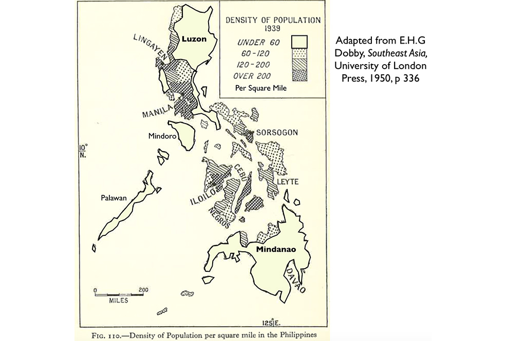
Central Luzon Region
- Population at Time of Event
6.339 Million Estimated (Region III – Central Luzon, 1990)
Previous Year's Gross Domestic Product (GDP)
$44.31 Billion USD (1990)
Previous Year's Gross Domestic Product Per Capita
$715.30 USD (1990)
Source(s)
• World Bank Group
• 2010 Census and Housing Population, Philippines National Statistics Office
[ Exposures ]
Principal Area of Impact
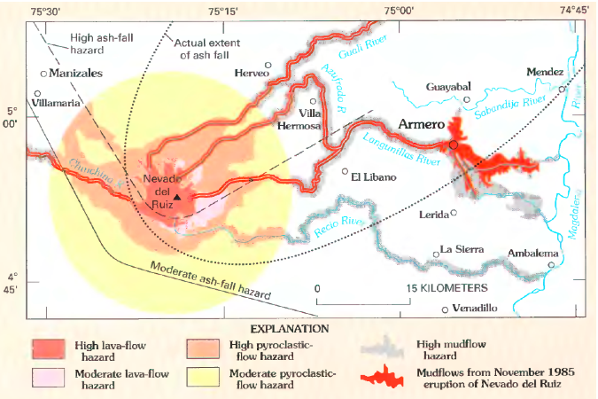
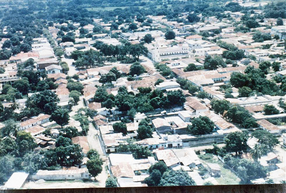
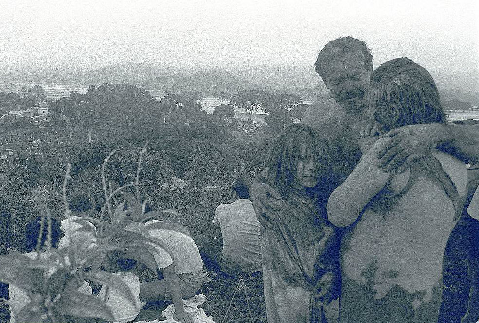
Armero /Central Colombia
- Population at Time of Event
2.113 Million Estimated (Caldas and Tolima Departments, 1985)
Previous Year's Gross Domestic Product (GDP)
$38.25 Billion USD (1984)
Previous Year's Gross Domestic Product Per Capita
$1,299.45 USD (1984)
Source(s)
• World Bank Group
• National Administrative Department of Statistics, Colombia
[ Vulnerabilities ]
Governance
World Bank Group Indicator –
Regulatory Quality (Percentile Rank):
Not Available
World Bank Group Indicator -Government Effectiveness (Percentile Rank):
Not Available
World Bank Group Indicator –
Rule of Law (Percentile Rank):
Not Available
World Bank Group Indicator – Voice and Accountability (Percentile Rank):
Not Available
World Bank Group Indicator – Political Stability and Absence of Violence (Percentile Rank):
Not Available
Corruption
World Bank Group Indicator – Control of Corruption (Percentile Rank):
Not Available
Transparency International Corruption Perception Index Score:
Not Available
Transparency International Corruption Perception Index Rank:
Not Available
Development
World Bank Group - GINI Index:
Not Available
Human Development Index Score (HDI):
0.586 (1990)
Human Development Index Rank (HDI):
Not Available
Source(s)
• World Bank Group
• Transparency International
• Human Development Report 1990
[ Vulnerabilities ]
Governance
World Bank Group Indicator –
Regulatory Quality (Percentile Rank):
Not Available
World Bank Group Indicator -Government Effectiveness (Percentile Rank):
Not Available
World Bank Group Indicator –
Rule of Law (Percentile Rank):
Not Available
World Bank Group Indicator – Voice and Accountability (Percentile Rank):
Not Available
World Bank Group Indicator – Political Stability and Absence of Violence (Percentile Rank):
Not Available
Corruption
World Bank Group Indicator – Control of Corruption (Percentile Rank):
Not Available
Transparency International Corruption Perception Index Score:
Not Available
Transparency International Corruption Perception Index Rank:
Not Available
Development
World Bank Group - GINI Index:
Not Available
Human Development Index Score (HDI):
Not Available
Human Development Index Rank (HDI):
Not Available
Source(s)
• World Bank Group
• Transparency International
DR
CatR
[Risk]