Hazard: Volcano

Country: Philippines

H
[ Hazard ]
Mount Pinatubo

Event Date

June 15, 1991

Volcanic Explosivity Index (VEI)

6

Notable Features

• Largest Eruption to affect a densely populated area
• Mud flows/avalanches were generated
• Volcanic ash cloud of hundreds of miles was developed
• Impacts of the eruption continue to this day.

Source(s)

• USGS

Videos  Gallery 
Hazard: Volcano

Country: Colombia

H
[ Hazard ]
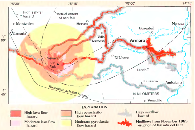
Nevado del Ruiz

Event Date

November 13, 1985

Volcanic Explosivity Index (VEI)

3

Notable Features

• Second largest volcano-related disaster of 20th Century
• Mud flows/avalanches were generated

Source(s)

• USGS
• NOAA

Videos  Gallery 
Ex
[ Exposures ]
Mount Pinatubo

Principal Area of Impact

Central Luzon Region

  • Population at Time of Event
    6.339 Million Estimated (Region III – Central Luzon, 1990)

Previous Year's Gross Domestic Product (GDP)

$44.31 Billion USD (1990)

Previous Year's Gross Domestic Product Per Capita

$715.30 USD (1990)

Source(s)

• World Bank Group
• 2010 Census and Housing Population, Philippines National Statistics Office

Videos  Gallery 
Ex
[ Exposures ]
Nevado del Ruiz

Principal Area of Impact

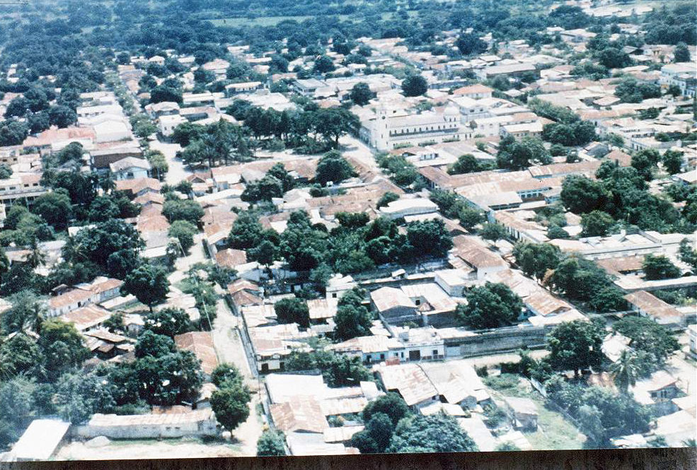
Armero /Central Colombia

  • Population at Time of Event
    2.113 Million Estimated (Caldas and Tolima Departments, 1985)

Previous Year's Gross Domestic Product (GDP)

$38.25 Billion USD (1984)

Previous Year's Gross Domestic Product Per Capita

$1,299.45 USD (1984)

Source(s)

• World Bank Group
• National Administrative Department of Statistics, Colombia

Videos  Gallery 
V
[ Vulnerabilities ]
Mount Pinatubo

Governance

World Bank Group Indicator –
Regulatory Quality (Percentile Rank):

Not Available

World Bank Group Indicator -Government Effectiveness (Percentile Rank):
Not Available

World Bank Group Indicator –
Rule of Law (Percentile Rank):
Not Available

World Bank Group Indicator – Voice and Accountability (Percentile Rank):
Not Available

World Bank Group Indicator – Political Stability and Absence of Violence (Percentile Rank):
Not Available

Corruption

World Bank Group Indicator – Control of Corruption (Percentile Rank):
Not Available

Transparency International Corruption Perception Index Score:
Not Available

Transparency International Corruption Perception Index Rank:
Not Available

Development

World Bank Group - GINI Index:
Not Available

Human Development Index Score (HDI):
0.586 (1990)

Human Development Index Rank (HDI):
Not Available

Source(s)

• World Bank Group
• Transparency International
• Human Development Report 1990

Videos  Gallery 
V
[ Vulnerabilities ]
Nevado del Ruiz

Governance

World Bank Group Indicator –
Regulatory Quality (Percentile Rank):

Not Available

World Bank Group Indicator -Government Effectiveness (Percentile Rank):
Not Available

World Bank Group Indicator –
Rule of Law (Percentile Rank):
Not Available

World Bank Group Indicator – Voice and Accountability (Percentile Rank):
Not Available

World Bank Group Indicator – Political Stability and Absence of Violence (Percentile Rank):
Not Available

Corruption

World Bank Group Indicator – Control of Corruption (Percentile Rank):
Not Available

Transparency International Corruption Perception Index Score:
Not Available

Transparency International Corruption Perception Index Rank:
Not Available

Development

World Bank Group - GINI Index:
Not Available

Human Development Index Score (HDI):
Not Available

Human Development Index Rank (HDI):
Not Available

Source(s)

• World Bank Group
• Transparency International

Videos  Gallery 
EmR
DR
CatR

[Risk]
Mount Pinatubo

Total Affected Population

1,036,065

  • Total Deaths
    640
  • Injured
    Not Available
  • Homeless
    Not Available

Total Damage

$367.14 Million (In 2015 USD)

Source(s)

• EM-DAT
• CPI Calculator

Videos  Gallery 
EmR
DR
CatR

[Risk]
Nevado del Ruiz

Total Affected Population

12,700

  • Total Deaths
    21,800
  • Injured
    5,000
  • Homeless
    Not Available

Total Damage

$2.2 Billion (In 2015 USD)

Source(s)

• EM-DAT
• CPI Calculator

Videos  Gallery 

Takeaways

With decades of perspective now on these two volcano hazard events, it is clear that the November 13, 1985 Nevado del Ruiz eruption and subsequent lahar (a mixture of ice, rocks, superheated mud, and other debris triggered by a volcanic eruption) qualifies as a true catastrophe for the city of Armero, its principal zone of human impact, of which only a remnant (and relocated) town remains. The June 15, 1991 Pinatubo eruption, however, qualifies as “only” a disaster for its principal impact area because scientific monitoring systems worked with a functioning public alert-warning-evacuation process to avoid massive life loss.

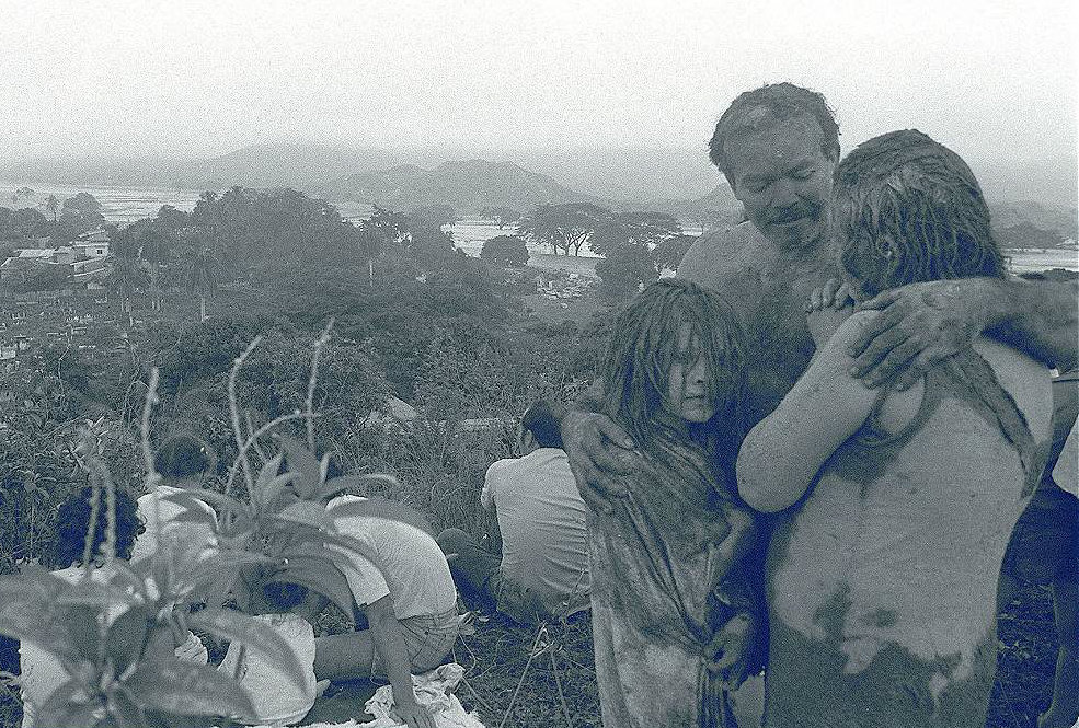
Nevado del Ruiz and Armero 1985. Siting what would become the Colombian city of Armero on a solidified lahar from a documented 1845 volcanic event is a classic example of “in harm’s way” exposure, against which very little physical vulnerability reduction was taken or really could be, given its location. Showing precursors a few months earlier, the Nevado del Ruiz volcano erupted on the night of November 13, 1985, melting part of its icecap and sending a lahar down its upper valleys, destroying villages, and then down toward Armero in the larger valley below. The lahar trapped and killed – in minutes – most of the city’s pre-event population of approximately 30,000 (a total EM-DAT death toll of 21,800). Given the “fixed” location of its economic and infrastructure assets, Armero’s only practical risk reduction strategy was an alert-warning-evacuation system for its human population, which utterly failed. While Nevado del Ruiz was in fact being monitored pre-eruption, the technology was not real-time, and the meaning of the data was variously interpreted, misinterpreted, and even denied. As Voight (1990: 383) summarized:

The catastrophe … was caused, purely and simply, by cumulative human error – by misjudgment, indecision and bureaucratic shortsightedness. In the end, the authorities were unwilling to bear the economic or political costs of early evacuation or a false alarm, and they delayed action to the last possible minute. Catastrophe was the calculated risk, and nature cast the die…. Armero could have produced no victims, and therein lies its immense tragedy.

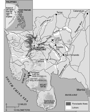
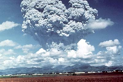
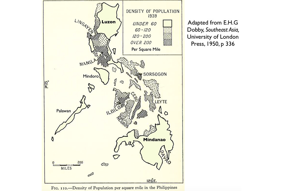
Pinatubo 1991. Mt. Pinatubo had been relatively dormant for more than 500 years, but after some earlier warning signs, it erupted massively on June 15, 1991, killing a reported 640 people (EM-DAT). Despite a relatively large human exposure that had built up over many decades in the predominantly agricultural areas around the volcano, where soil is exceptionally and attractively fertile, the Pinatubo case saw a very effective alert-warning-evacuation process. Based on real-time monitoring systems, national and international scientific communities, government decision-makers, local communities, emergency management officials, and the Philippine and U.S. militaries achieved an effective consensus and organized timely evacuations:

As many as 20,000 lives were saved as a consequence…. Despite considerable uncertainties, the eruption was correctly forecast and more than 85,000 were evacuated…. Although about 200,000 were “permanently displaced” by lahars, only about 400 fatalities are attributed to lahars. Timely warnings from scientists and police helped to keep most people safe (GVM 2015: 18-19).

As these two cases illustrate, not much can be done about volcano risk to most economic and infrastructure assets (they tend to be fixed in place, and vulnerability reduction options are limited in practical terms). For human population exposures, however, much can be accomplished because volcano eruptions usually show precursors. The key takeaway for our equation is thus about the importance to human life safety of effective and real-time monitoring and data interpretation, and then communication, coordination, credibility, and trust between (a) the scientific community, (b) emergency management officials, (c) political authorities, and (d) the likely most affected public.

Cited References: Global Volcano Model (GVM). International Association of Volcanology and Chemistry of the Earth’s Interior Global volcanic hazards and risk, Technical background paper for the UN-ISDR Global Assessment Report on Disaster Risk Reduction 2015

- Richard S. Olson, Ph.D.