Subgrid correction of storm surge modeling in orthogonal curvilinear coordinates
Hurricane Irma Coastal Flooding Depth in South Florida Mangrove Forests using the Subgrid CEST model
FIU receives $1M for storm surge risk mapping throughout the Caribbean
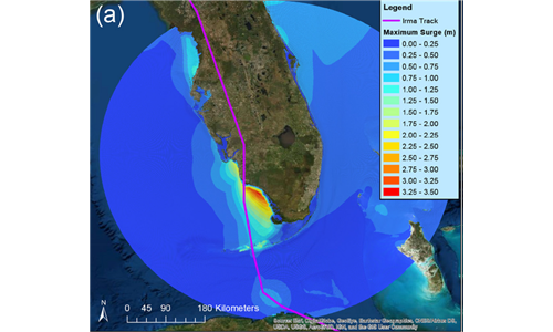
Hurricane Irma Simulation at South Florida Using the Parallel CEST Model
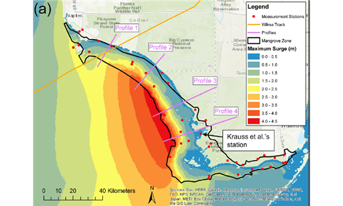
Improved modeling of the role of mangroves in storm surge attenuation